
Thanksgiving break gave me the opportunity to stray far and wide: I even went to the World’s Edge!
Just over an hour and a half away on the wild southern edge of Chimney Rock State Park, World’s Edge is a sheer 1,400-foot cliff along the edge of the Blue Ridge Escarpment.
The trail lies at the end of World’s Edge Road, where a gate blocks the transition to dirt at Ottanola Gap.
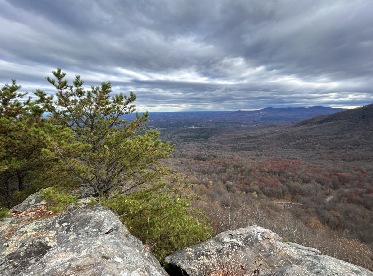
Following the dirt road will lead you to a sheer drop-off on your right, the World’s Edge cliff, providing a magnificent view of the rolling hills of the Piedmont.
You can continue along the edge of the cliff on a narrow, somewhat overgrown footpath, ducking around trees and bushes, dotting from rock to rock along the steep cliffs. There is also a dirt road on the north side of the ridge, which the footpath ducks out and back from.
The path along the cliffs is untrimmed, unmaintained and unmarked. Long pants and sturdy shoes are strongly recommended, but the wild, untamed spirit of the place is like little else you can get to without a long hike.
The steep drop-offs and wild trail contribute to the remote feeling of the place, watching the soaring raptors, letting you feel like you’ve truly escaped into the wilderness for a moment despite being less than a mile from your car.
It continues on the edge for about a mile, with sweeping views of the rolling hills and Mount Tryon. On the horizon to the south, the outline of Crowders Mountain is visible, along with the beautiful South Mountains to the east.
Winter is especially nice, as the views often extend in all directions with the leaves off of the trees. You can look to the north and see Chimney Rock Mountain and the Hickory Nut Gorge. You might even catch views of the Black Mountains in the distance, the highest range in eastern North America.
The trail is best hiked as a two-mile out and back, heading out along the cliffside on the way down and returning along the forest road. It is only about 400 feet of elevation change, but that makes it sound far steeper than it is. The hike should take you about two hours, but you might want to add some time to bask in the views.
Due to the unmarked nature of the trail, a good map, compass and basic hiking gear are recommended, even for this short trail. Be careful with GPS apps, but they can be a great help in situations like this.